Source photo Marcins Berzins from Unsplash
It will take over one billion dollars to protect one small Louisiana town from climate change
As floodwaters regularly rise in southeast Louisiana, so do the costs to protect communities
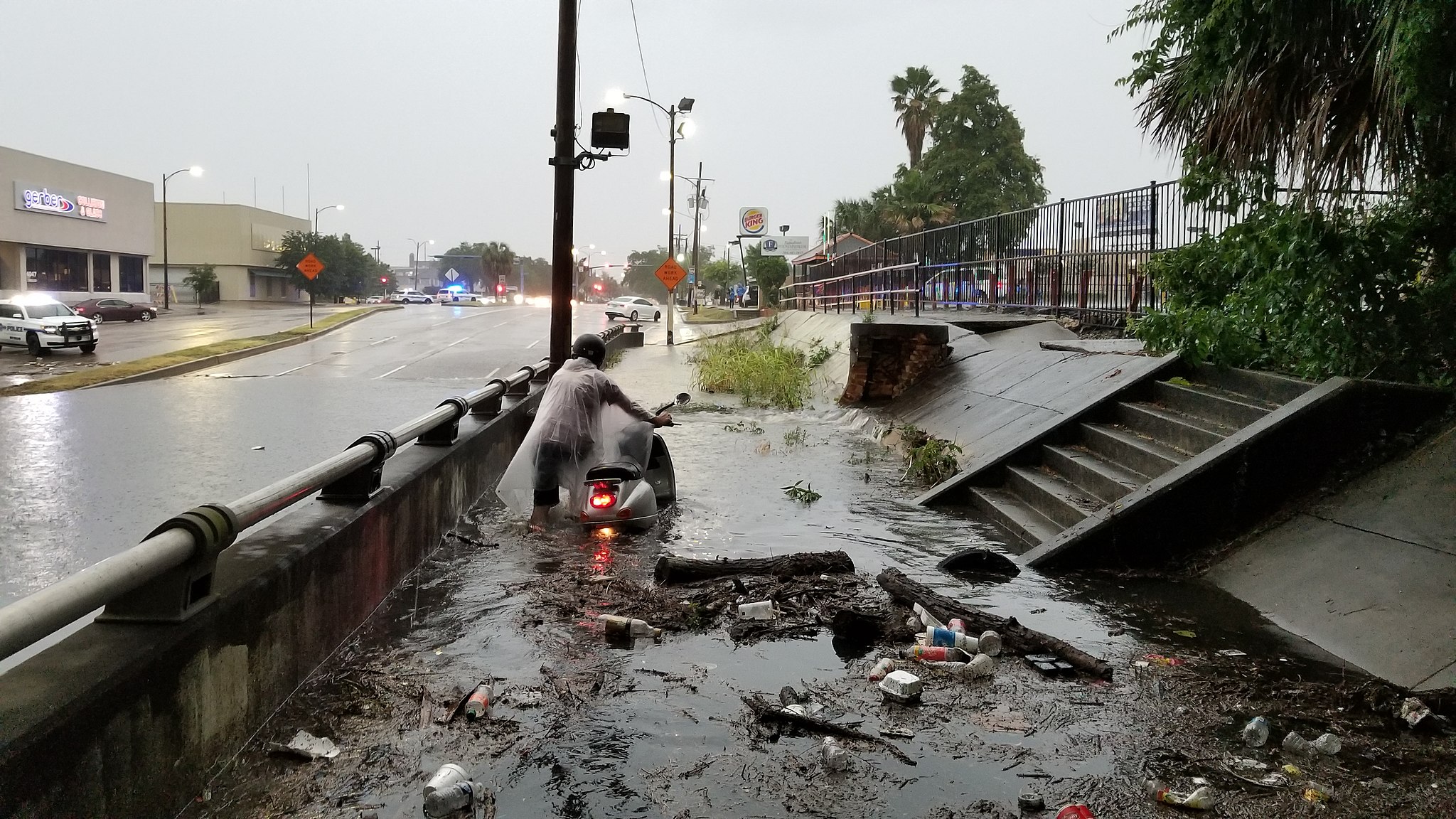
One rainy August, Jordan Stadler spent all night ferrying friends and strangers around his neighborhood in his granddad's canoe. Rising water in the streets had been stranding people at their cars and doorsteps. And that particular flood wasn’t even due to a storm or high river levels. Sometimes in New Orleans there’s just so much water it has nowhere to go.
Stadler, a lifelong resident of southeastern Louisiana in his late 20s, has since had second thoughts about investing in property in New Orleans. He's been flooded out of various homes at least five times since he was a kid. Buying here just doesn't make sense to him anymore.
“I'd like to cite the 2017 flood,” Stadler said, about his decision to give up on buying property in New Orleans. “Just some crazy heavy rain, and then all of a sudden you saw water gushing from multiple manhole covers and you're like, 'Oh god, this is getting bad.' "
About 30 miles downriver from New Orleans, in the coastal area of Lafitte, a region similar to where Stadler went to college, the flooding situation is even worse. Between 1973 and 2010, rising seas and an eroding coastline brought the lapping front of the Gulf of Mexico 7.4 km (4.5 miles) inland, crowding Lafitte's 4,700 residents onto less and less dry land. The region is home to four historic coastal communities. Its flood risk is high, but so is its cultural value.

Jordan Stadler on his new sailboat, where he lives full time
Photo by Joan Meiners
The costs and challenges of protecting this area from flooding are the focus of a recent paper by Christopher Siverd and other scientists at Louisiana State University (LSU), published this past January in the journal Climatic Change. They modeled flood risk for the Lafitte communities based on future sea level rise scenarios and the storm surge forces of 2012’s Hurricane Isaac, the most significant storm to hit the area in recent years.
As the paper notes, Lafitte is currently protected from Gulf storm surges by 14.5 kilometers (9 miles) of raised earthen barriers, or levees. In 2012, Louisiana’s Coastal Protection and Restoration Authority proposed building a ring of levees 47.5 kilometers (29.5 miles) long to protect the area, but the project has been contentious largely because of its price tag.
Siverd and colleagues looked at exactly how much it would cost, per person, to truly save this area from flooding as sea rise worsens, due to thermal expansion and the melting of the polar ice caps, and subsidence, a phenomenon that causes the ground surface to sink due to underwater oil and gas extraction and a lack of influx of new sediment. They found that, by the year 2110, the proposed levee barriers would have to be nearly 8 meters (about 26 feet) high to effectively block water from an incoming hurricane of Isaac’s strength. The cost of this measure, if the population of Lafitte stayed constant, would exceed $300,000 per resident, or about $1.4 billion for all 4700 people in Lafitte.

New Orleans during a May 2018 flood after a rain storm
Wikimedia Commons
Just as Stadler questions the sanity of buying property in New Orleans these days, this finding casts doubt on the feasibility of holding back this rising tide. The risk of flooding in southeastern Louisiana has steadily increased in recent years, with threats looming in from all sides. From the north, the Mississippi River channels upstream rainwater into the area, while, from the south, rising seas allow worsening storms to approach ever closer. Now, in a first, the Bonnet Carre Spillway – a gate of sorts that releases water from the Mississippi River into New Orleans’ Lake Pontchartrain – has been opened for the third year in a row in an attempt to reduce the risk of flooding homes.
Meanwhile, Louisiana is losing about a football field's worth of wetlands every 100 minutes. The land erodes away into open water because the levees preventing the Mississippi River from flooding its banks have also channeled all of the river's sediment out into the Gulf of Mexico. Soil that used to fan out slowly over inland marshes and help build land in the delta during regular flooding is now spit out to sea in deeper channels. A 2010 report by Earth Economics found that these wetlands provide ecosystem services worth between $12 and $47 billion annually

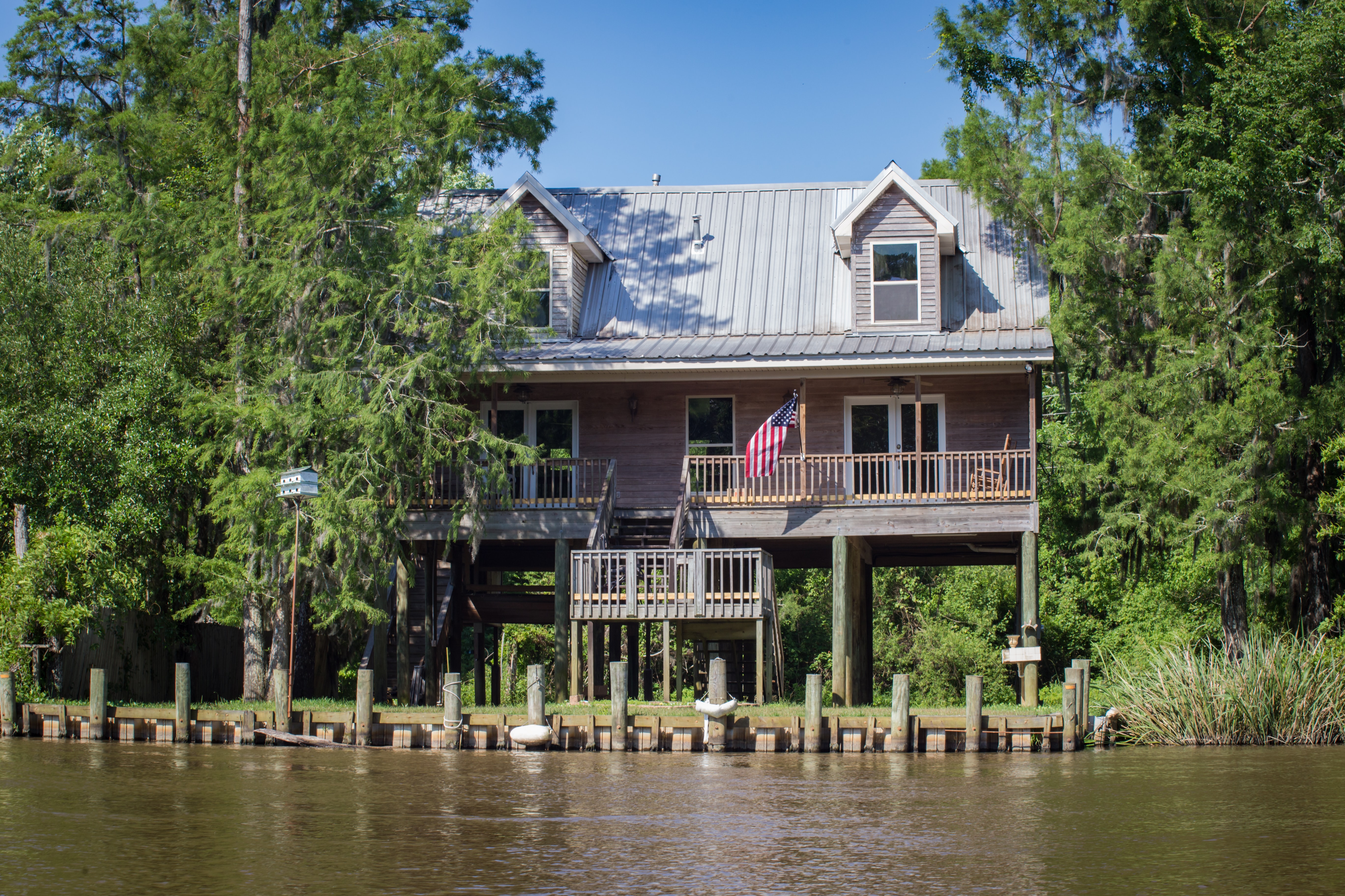
A house in Slidell, a suburb of New Orleans, is raised to prevent flood damage.
In addition to the protective levee barriers for Lafitte, Louisiana's Coastal Master Plan also proposes river diversions that would return sediment to areas that have lost it by allowing the Mississippi to breach its barrier at specific spots and flow a new course. But the process of rebuilding marshes is slow, and increasingly intense hurricanes are a threat each summer now. While the Bonnet Carre Spillway provides some relief from flood risk for New Orleans, it may not be possible to restore the wetlands enough to save Lafitte. Recognizing this, the paper concludes by suggesting that, in rural areas like Lafitte, elevating homes above flood levels might be more cost-effective than building the necessary levees.
As for Stadler and his search for flood-proof real estate in southeastern Louisiana? He now lives happily on a 41-foot boat.
"Why do people go back to disaster areas?" Stadler asks. "That’s home. That’s where it’s natural to be."
